


Zevtt - My La Mothe St Héray

kipoura
Gebruiker

Lengte
54 km

Max. hoogte
199 m

Positief hoogteverschil
845 m
Km-Effort
66 km

Min. hoogte
74 m

Negatief hoogteverschil
849 m
Boucle
Ja
Datum van aanmaak :
2019-05-03 17:10:40.394
Laatste wijziging :
2019-05-03 17:10:40.519
3h30
Moeilijkheid : Moeilijk

Gratisgps-wandelapplicatie
 SityTrail
IGN / Geografische instituten
SityTrail Plus
De wereld gaat voor u open
Over ons
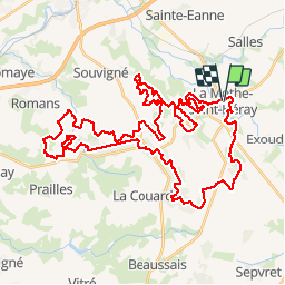
Tocht Mountainbike van 54 km beschikbaar op Nieuw-Aquitanië, Deux-Sèvres, La Mothe-Saint-Héray. Deze tocht wordt voorgesteld door kipoura.
Beschrijving
Un trés beau parcours de VTT au départ de la Mothe St Héray. Un circuit physique, mais plein de plaisir .... http://zevtt.free.fr
Plaatsbepaling
Land:
France
Regio :
Nieuw-Aquitanië
Departement/Provincie :
Deux-Sèvres
Gemeente :
La Mothe-Saint-Héray
Locatie:
Unknown
Vertrek:(Dec)
Vertrek:(UTM)
722178 ; 5138170 (30T) N.
Opmerkingen